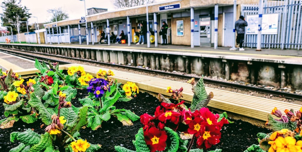
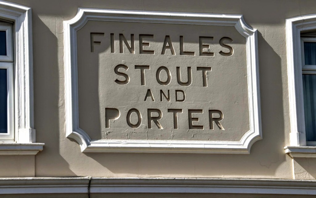
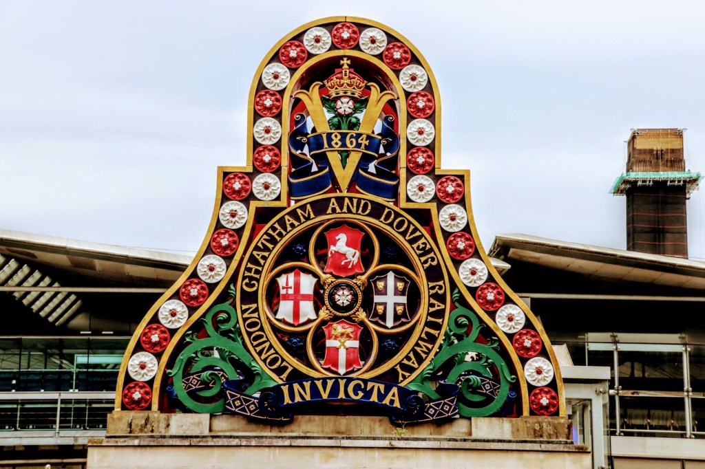
The station opened in July 1900 as Slades Green to serve as a rail depot where up to 100 steam locomotives were maintained. The depot, now operated by Southeastern, is still there, and it’s about 100 metres due east of the station. The station was renamed Slade Green in 1953.
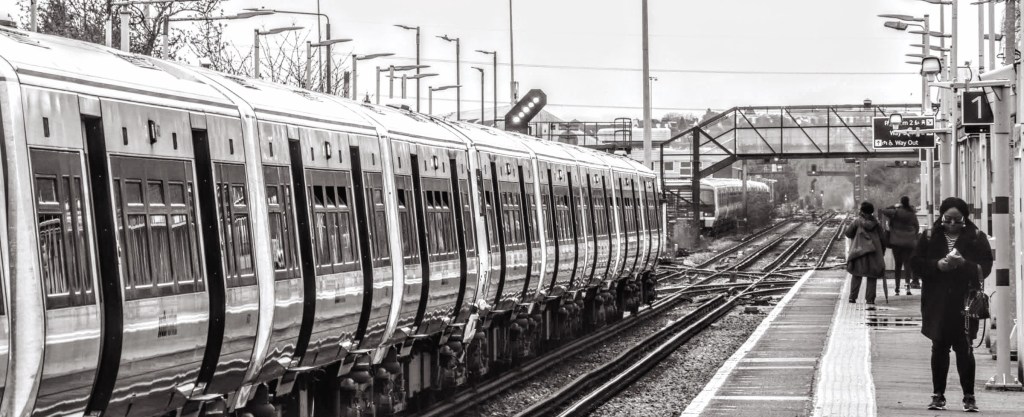
Southeastern manages this tired and grubby station, although Thameslink trains also operate through here. The station isn’t an obvious end of the line, but the reason for my visit is that it is the midpoint for Southeastern’s loop service to and from Cannon Street station. It’s the station where drivers swap over. Getting here can be confusing as station announcements mid-way through the journey change the destination from Slade Green to Eltham. That’s because the service continues through and returns to London in a clockwise direction via Lewisham. Those travelling anticlockwise do so via Woolwich and Greenwich.
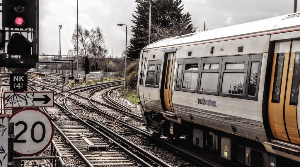
The following photo shows the complex track layout with Southeastern services deviating along the curve to the right following Howbury Lane, headed to Barnehurst, the next stop. Class 465 rolling stock are the predominant Southeastern workhorses. The line goes straight on, but from my observations, it was for the Thameslink Trains headed to Rainham (Kent) and for trains accessing the maintenance depot.
As a regular reader, you’ll know I rarely plan my journeys once I’ve left the station. However, today I planned to make my way to Erith Pier, although I was undecided on how to get there. So as I left the station on the eastern side, it seemed only natural that I stay on this side of the tracks.
There’s a small shopping precinct opposite the station, which is no doubt used by those working at the maintenance depot. I did try accessing the depot, but its gated entrance put a stop to that. So instead, a walk around the side takes me into Oak Road, where there’s a collection of railway cottages. The road goes no further, but you can pick up the London Loop here, which takes you across Crayford Marshes, following the river around to Erith. I chose not to, although I will pick up the London Loop a little later.
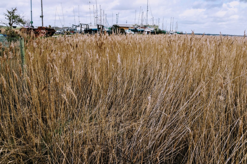
Crayford Marshes is designated a Sight Of Special Scientific Interest for its diverse wildlife. There’s also some modern history associated with the Marshes, as during and after World War I, there were two ordnance factories here – the Thames Ammunition Works and a Trench Warfare Filling Factory. Located partly because of their remoteness and no doubt because the rivers that form the boundary for the Marshes, the Cray and Darent, flow into The Thames. Read the associated links, as there’s some fascinating history about the factories.
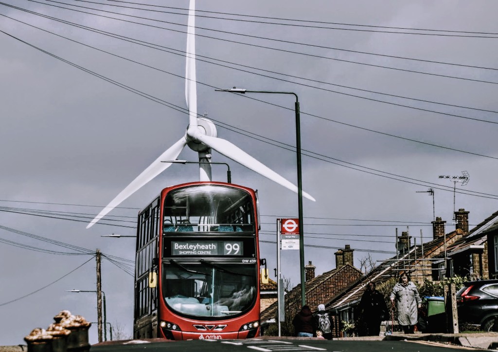
I walk north through a predominantly residential area and notice road signs for Erith Yacht Club, so I make it my next destination through Slade Green Road and onto Manor Road, which has a sizeable industrialised warehouse conurbation. But I do stop for the number 99 bus headed towards Bexleyheath Shopping Centre. Not that I want the bus, but its juxtaposition with the wind turbine in the background makes for a whimsical photo. Tell me what you think.
I follow the signs to the Yacht Club down a zig-zaggy lane, but the nearest I can get is to the secure high fence about 100 metres from the clubhouse. There are many boats on dry land, and from where I’m standing, their empty masts look like unfinished scaffolding.
The lane picks up the London Loop path again, and I’m tempted to follow the footpath. But I decide it’s a step for the more adventurous rambler and wildlife enthusiast who may have a different timescale to enjoy their surroundings. I’m saddened, though, because, at this point, thoughtless fly-tippers have indiscriminately dumped what looks like a mix of domestic and industrial rubbish. Maybe the London Borough of Bexley will investigate?

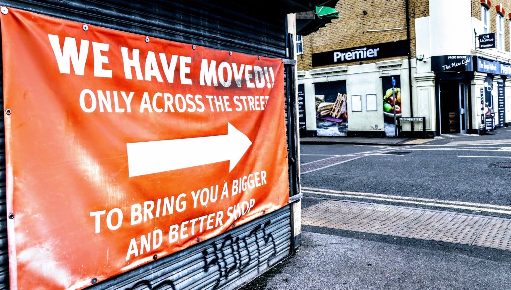
I return to the main road and walk as far as the Premier convenience store on the corner of Manor Road and Appold Street, and I’m amused by the sign on the old Erith Mini Market on the opposite corner. You’ll see from the photo below why — the large sign with a shop-size arrow points to where they have moved. You can’t miss it.
Overlooking The Thames
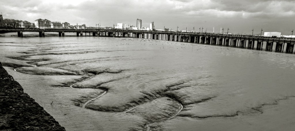
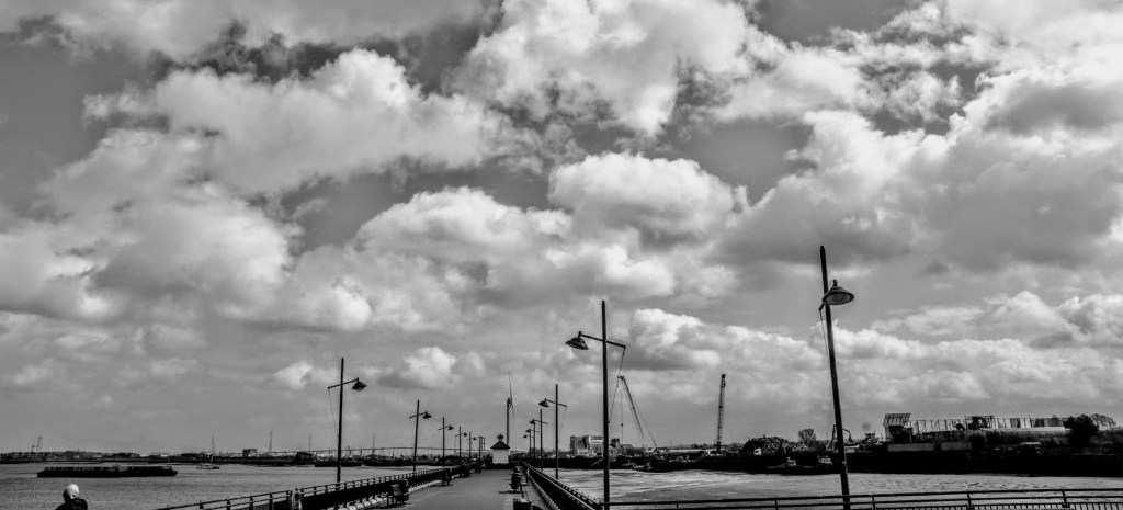
Appold Street leads down to the river, and the whole expanse of Erith Pier is before me as I look upriver. Its sweeping boomerang shape appears trapped in the murky tidal mud, with the London skyline as a backdrop. The foreground captures a slithering creek weaving its way through the mud in search of an outlet whilst the wading birds peck at the grubs in anticipation of the tide covering their tracks.
In the opposite direction, the scene is that of a working industrial London. Somewhat stilted as the tide is out and boats are trapped in the mud. But in the foreground, there’s a scrap yard and Erith Yacht Club. You can also make out the Queen Elizabeth II Bridge as it crosses the river at Dartford, five kilometres away as the crow flies.

As you follow the riverside path, you need to detour around and through Pier Square and clamber over the steps that take you over the flood barrier to access the pier. But once you make that, the views are spectacular. Type ‘Erith Pier’ into your favourite internet search engine, and you’ll get loads of sites to read about the pier’s history, dubbed London’s Longest Pier. I’ve found several worth reading through, although they seem to say pretty much the same. Here’s a selection: Erith Museum, London Unwrapped, Wait until next year and Londonist.
Let me precis what you’ll read. A wooden pier was built here in the mid-1800s that attracted ‘the gentleman commuter of the day’. And at their leisure, they would also enjoy the steamship journey to Gravesend, which turned out to be a Victorian equivalent of a booze cruise. However, the arrival of the railway and the opening of the Crossness Sewage Works soon afterwards put a spanner in the works, and the pier became less attractive.
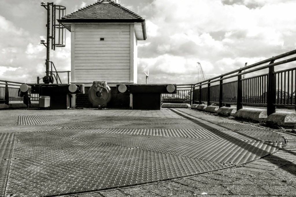
By the turn of the century, the pier and adjoining land were taken over by coal merchants and by the 1950s, the pier was replaced by the concrete one we see today. However, the pier survived as a maritime and industrial gateway offering a docking berth for several cargo ships. The turntable and buffers you’ll see at the end of the pier today symbolise how the cargo would have been transported from the ships along a narrow gauge railway onto land.
The maritime industry declined through the 1970s, and the pier lay abandoned until the 1990s. Morrisons took over the adjacent land to build a large superstore, and as part of the development, they invested in the pier, which then became a leisure showpiece. This a somewhat bitter-sweet relationship as, from my observation, the arrival of the superstore effectively killed off the local retail trade. But more on this later.
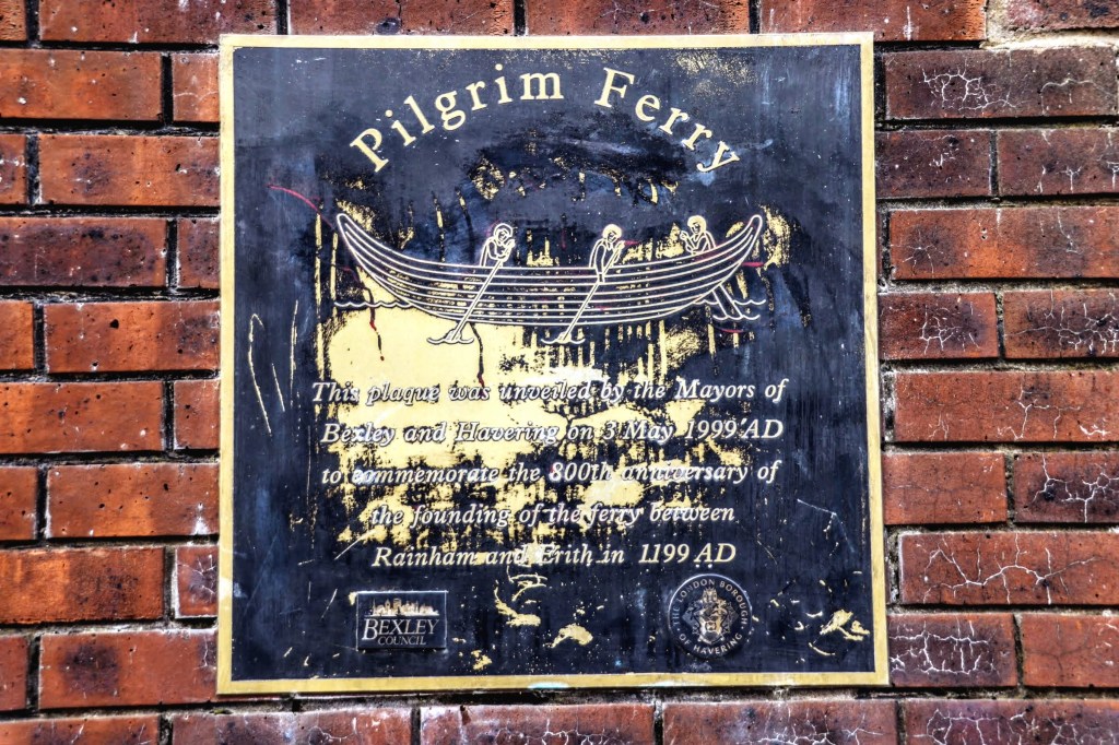
A little further along the pathway at William Cory Promenade, I make my way to the Causeway. I’ve written about it below as it features my picture of the day. But I also found a plaque I saw on the other side of the river when I visited Rainham (Essex) over two years ago. The plaque commemorates the ferry founded in 1199 between the two locations, and it was nice seeing the story from the other side of the water.
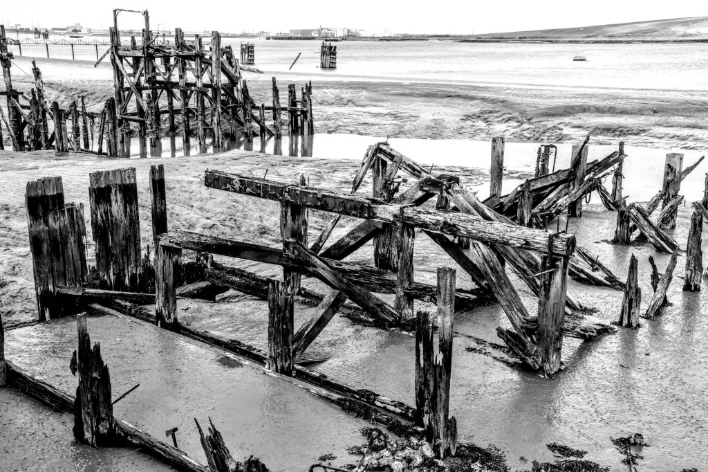
I continued along the water’s edge for a little while, enjoying the river views. The walk is in the shade as this stretch has seen the new apartment blocks built in recent years. I stop at the end of Chandler’s Drive as there’s an unfinished development with a covered walkway. But before turning tail to head into Erith, I admire a long abandoned and forgotten pier. No doubt a casualty of the changing maritime fortunes of the area.
Lost and Forgotten pubs
Along my route, I passed three buildings with a ‘pub’ feel to them, so I took some photos for their architectural interest. Not knowing their pedigree, some internet research unearthed several useful and interesting websites. So, first of all, my thanks to Derelict London, Pub History and Dover-Kent.
I was right. They were pubs with a colourful history too. They were:
The Railway Tavern – The pub closed long ago and was converted into flats in 2006. The building is diagonally opposite the station on the corner of Forest Road and Moat Lane and would have been an ideal boozer for those working at the maintenance depot. One commentator describes it as a friendly, busy pub full of colourful characters. Read the Derelict London website for an eye-opening story about how all the patrons did not see a grudge killing as they were all in the small toilet at the same time.

The Lord Raglan – halfway along Hazel Road, the Lord Raglan opened in 1855. It was rebuilt in 1900 and closed in 2013. It has since been converted into residential property. I spoke with one resident who said the pub had quite a reputation, but she didn’t elaborate.
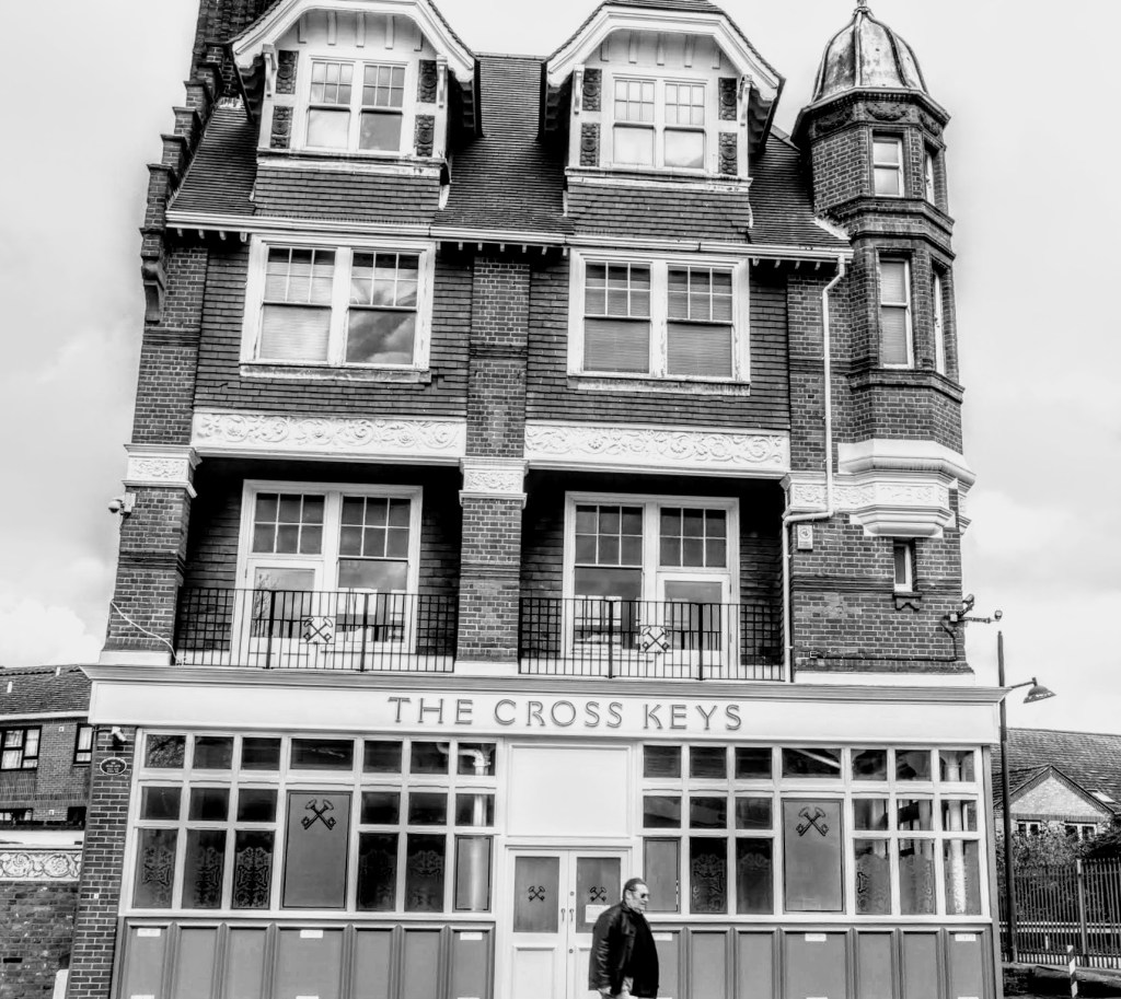
Cross Keys – positioned on Erith High Street, just down the road from the Playhouse. First opened in 1828, this pub has a very chequered past, and it was closed down by the police in 2010, for what the News Shopper headlined – ‘Cross Keys loses licence after horses were taken into the pub’. The pub was also the subject of underage drinking in 2008. Since 2015, it has been converted to a building of mixed-use.
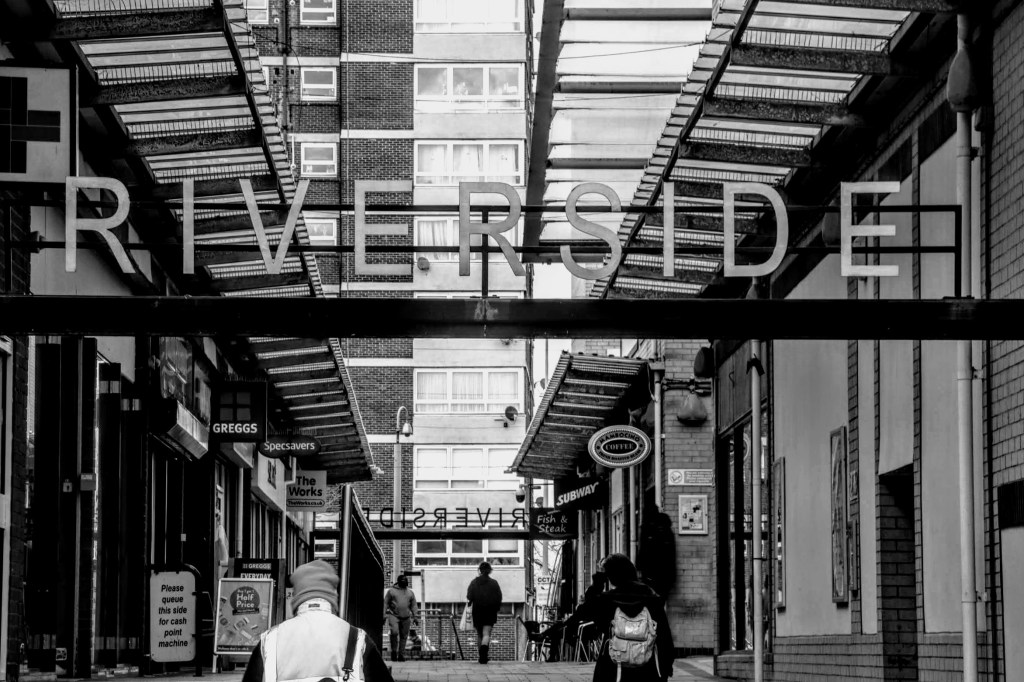
I end my day looking around Erith, and with a heavy heart, I feel sad at the town’s state. As I walked around, the only thought that came to mind was it has a feel of a town forgotten by time. The Riverside Shopping Centre is very much a child of the 1960s, but with many empty units, it felt uninspiring and jaded. A property development company, BYM Capital, has recently taken it over. My only hope is that they will be sympathetic to its resurrection.
I believe the town has been forgotten because of the massive Morrisons Superstore nearby. Why would you go anywhere else when there’s easy parking? Forgive me, Erith, if you feel this is unjust. However, I’d be happy to be invited back to see what regeneration plans you have that will rekindle your town’s look and feel.
But all is not lost. As I headed to the station steeped in industrial history, I discovered an uplifting mural in the Stonewood Road underpass next to London South East Colleges: Bexley. The work is a brilliant collaborative artwork by Steve Boyd-Brown and the Youth Unity Project. It was created to promote the work of Youth Unity CIC, a “not-for-profit organisation established to provide effective help and support to vulnerable young people and adults affected by group violence (gangs), drugs and other forms of exploitation such as human trafficking, CSE and extremism”.

I recognised Steve’s work instantly as I had spent some time chatting with him during my visit to Swanley, and I recall him telling me about his passion for urban art and as a youth worker. You can follow Steve on Instagram. I contacted Steve to ask him where the inspiration for the piece came from, and he replied with the following:
It represents the local community as it is a diverse environment, and I wanted to reflect that in the piece. I had so many positive responses from so many different people. I literally painted the whole mural freehand with no design references created beforehand.
This is indeed a testament to Steve’s artistic ability.
The End
Well, what a day this has been, and what a journey too. Today’s visit was somewhat emotional as it was the conclusion of my National Rail endoftheline travels across London. When I started out in August 2020, I had little idea visiting the 56 stations would be a two and a half year-long project. Of course, no one anticipated Covid restrictions returning and lasting as long as they did.
Nevertheless, and despite this, here I am, wondering what to do next.
Watch this space
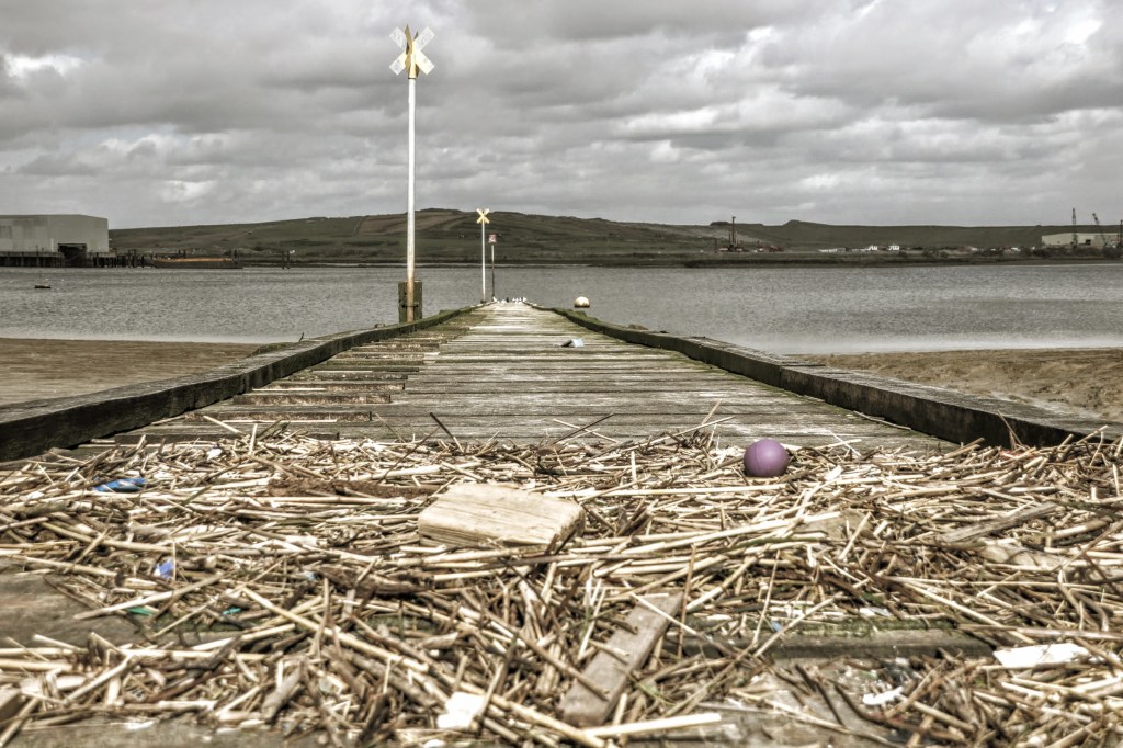
Picture of the Day – Erith Causeway
Just off Erith High Street, near the Playhouse, there’s a slip road leading to William Cory Promenade taking you along the water’s edge. The Causeway is directly ahead, although an unlocked latched gate controls access.
I’d spotted the causeway whilst standing on Erith Pier, and with the tide out, it looked isolated and abandoned, but I had decided it warranted a closer look. The latched gate was easy to open, so after a quick survey of the state of the woodwork and taking heed of The Port Of London Authority’s notices.
Oh yes, the notices read – Danger – deep water and strong currents; Danger – soft and deep mud; Extreme Caution – tread with care, slippery surfaces.
The wood in the slatted causeway was dry and in good condition, but I took more cautionary steps as I neared the tidal mark. And as the tide was on the turn, I decided on balance not to go any further. The view was breathtaking and would have been more stunning had I been surrounded by water. Nevertheless, looking across The Thames, this view is a reminder that my journeys have crisscrossed the river countless times, and it seems fitting to feature it as my final image. In addition, the tidal debris in the foreground helps to provide some context to the composition.
I’ve played with the colour in post-production to heighten the cloudy sky and dampen the overall colour palette to create a slightly washed-out effect. I think it works. Do you?
- Location: William Cory Promenade, Erith
- Date/Time: Thursday 30th March 2023, 1.33 pm
- Settings: Camera – Canon EOS 200D; Aperture -f/8; Shutter Speed – 1/400; Focal Length – 28mm; Film Speed – ISO100
Social Media
Please follow me on my social media channels: Instagram, Facebook, and Twitter if you like what you see.


Leave a comment