
It was difficult to pin down when this station opened, which is part of the Oxted line that runs to East Grinstead and Uckfield. The line was conceived by two disputing rival train operators, who agreed to resolve their differences in the 1880s. The line also runs parallel with a separate branch line to Caterham, with two other nearby train stations serving the same community. They are Whyteleafe and Whyteleafe South, but more on them later.
However, Whyteleafe South was until 1956, named Warlingham. Consequently, Upper Warlingham was so-called as it was on slightly higher ground.
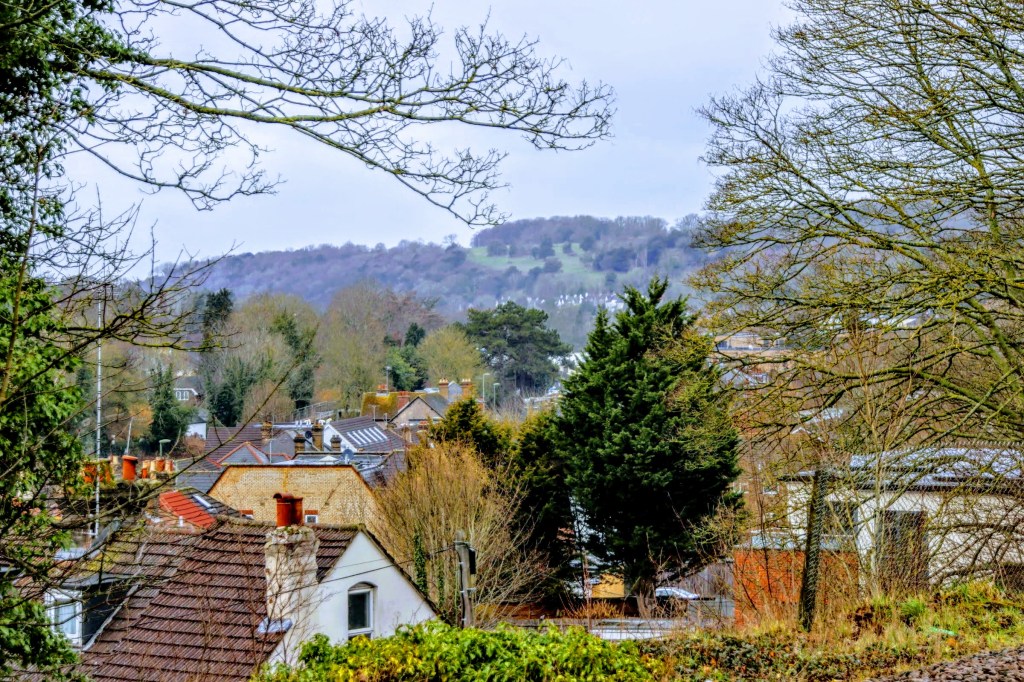
Trains are predominantly operated by Southern Rail to and from London Bridge and Victoria, although Thameslink trains also stop here during peak times. The station has little to offer over and above most others built during the Victorian railway explosion. However, the station boasts a magnificent view of the Downs and Riddlesdown Common from the front of the station
Let me introduce you to Kelly, the station’s ticket officer who’s passionate about the station she calls her own, as she has responsibility for all that goes on here. She’s passionate about her station, and as we chatted, I commented that she, like several other Southern Rail stations, collects donations for the Royal Marsden Hospital. She said she would also like to collect for a small Welsh independent animal sanctuary, but she wasn’t sure how the local passengers would take to that.
As I left Kelly to deal with customers, she was kind enough to pose for me and agreed to display some of my postcards in the waiting area. She said she would also pass on my details to Southern Rail media, who runs a monthly magazine, as they may be interested in my travel journey.

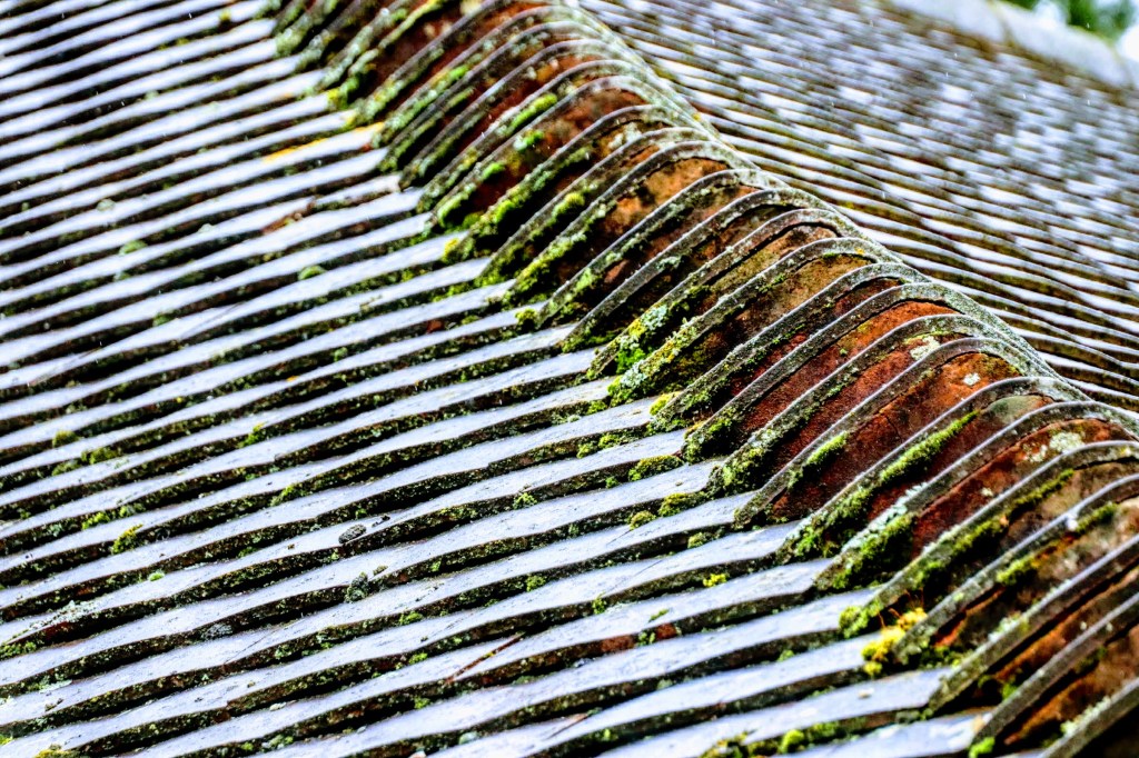
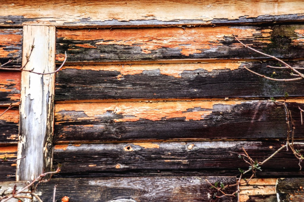
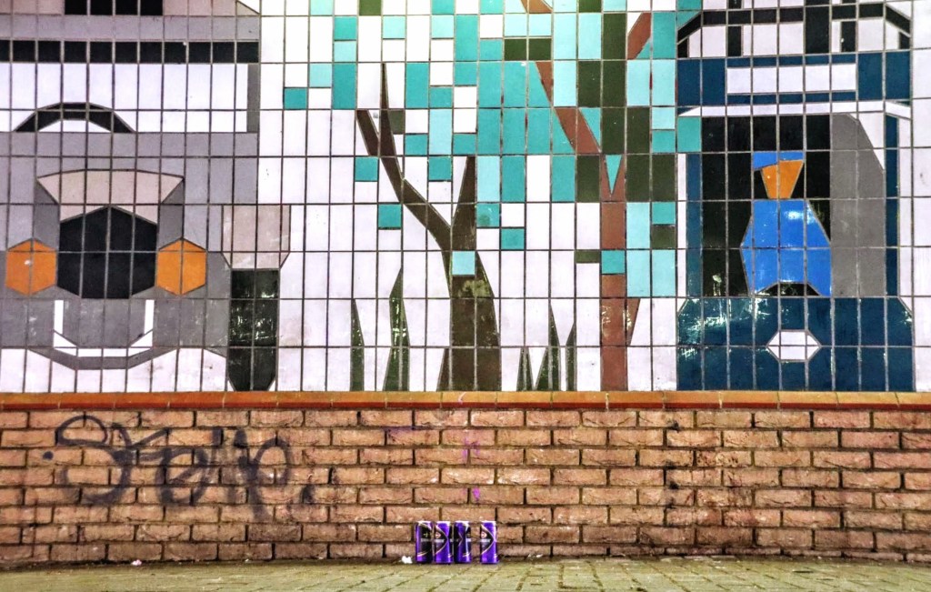
Before leaving the station, I took close-up shots of repeating patterns that caught my eye. Sometimes, I like the repetition and the colours, or sometimes, I play with settings. Regardless, I intend to build up a portfolio of stock photographs that may or not get used later. Anyway, maybe you’d let me know what you think?

Whyteleafe and Whyteleafe South Stations
It is important to include references to these stations because they are so close to Upper Warlingham. And what’s more, when searching rail routes to Upper Warlingham on travel maps, a journey to Whyteleafe is often suggested, followed by a walk to Upper Warlingham, which is only 500 metres away.
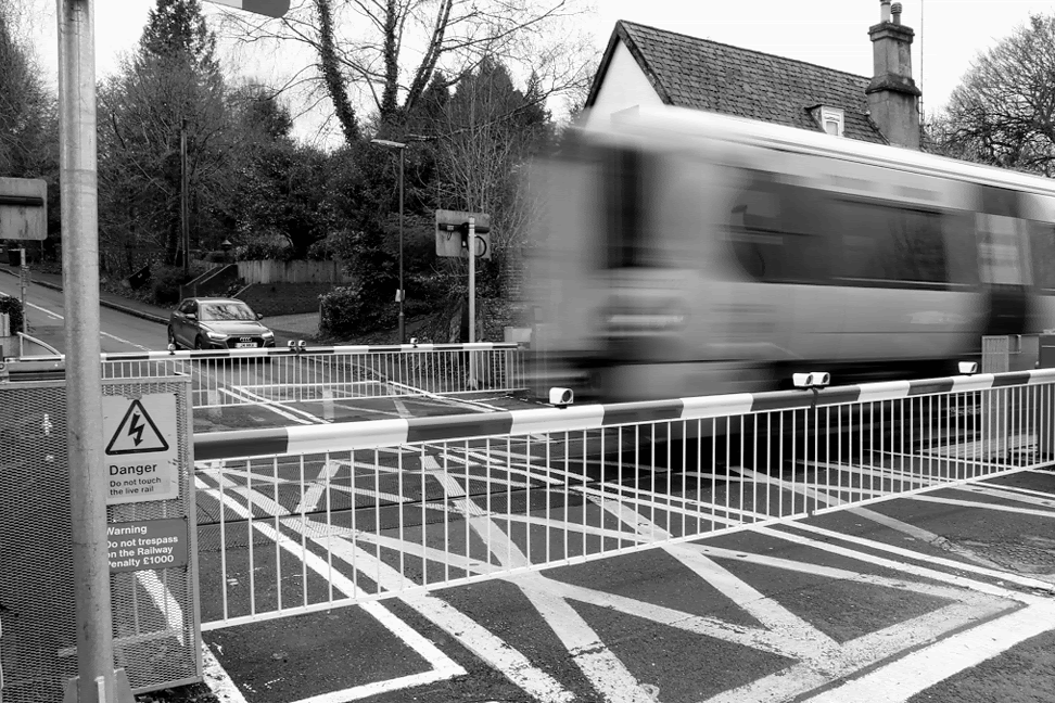
The boundary between Warlingham and Whyteleafe is the A22 Godstone Road, which runs north/south between the Oxted and Caterham railway lines. And these two stations lie on the western side of the divide along the Caterham line. The railway line at both stations crosses relatively minor roads, so there are only automated barriers to protect road users and passengers. The photo below is the 11:27 from Whyteleafe South to Caterham as it passes over Salmons Lane. The gates close some 5 minutes before the train’s arrival, and those waiting to cross did so patiently.
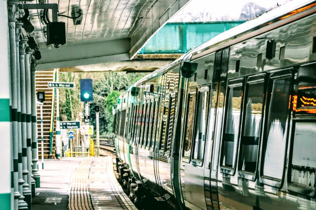
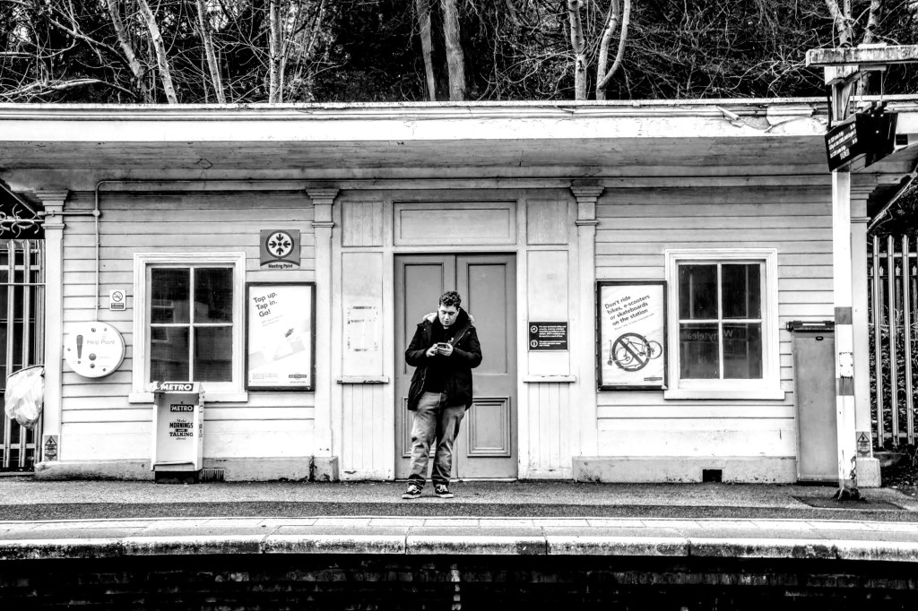
For completeness, here are a couple of images of the two stations. The first shows off Southern Rail’s reflected green livery at Whyteleafe. And the second is of a waiting passenger at Whyteleafe South. He saw me taking photos, but he was so engrossed in studying his mobile that he seemed not to care that I was lining him up for this shot.
Whyteleafe Recreation
The closest to either village I got to was the recreation ground and The Dobbin. The Dobbin is part of the Downlands Trust land, which stretches over to Sanderstead and Riddlesdown Common.
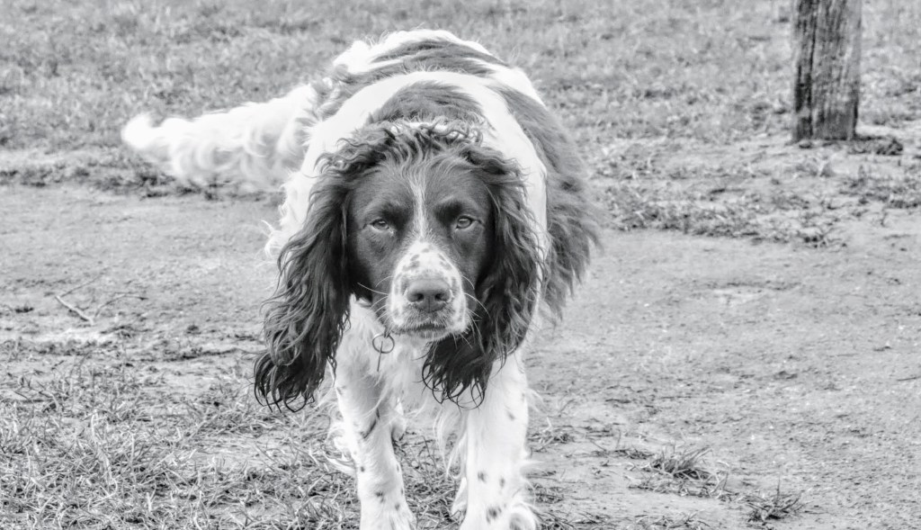
But first, as I enjoyed the expanse of the recreation ground, I stopped to chat with a dog walker inviting me to capture his dogs whilst running across the grounds. He had five dogs: two greyhounds crossbreed and three spaniels. The Spaniels were more in the mood to chase the ball I was throwing, but their speed was a particular challenge. Nevertheless, I managed to capture one shot of this spaniel in focus as he ran towards me. They were friendly enough despite the appearance suggesting otherwise in this photo.
From the grounds, I was undecided about which way to head next, and my dog companion suggested a hike up the Devil’s Steps and over the top, where I could head towards Kenley rail station. I don’t know if the Devil’s Steps is an official or a local name, but I can understand why they are so named. I saw this intrepid rambler walking alongside the steps and wondered why until I started climbing them myself. The steep and rugged steps break your stride pattern walking up, so I now understand that walking to one side made the ascent more bearable. Even so, a stop halfway was needed.
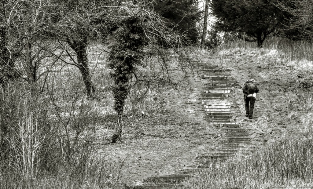
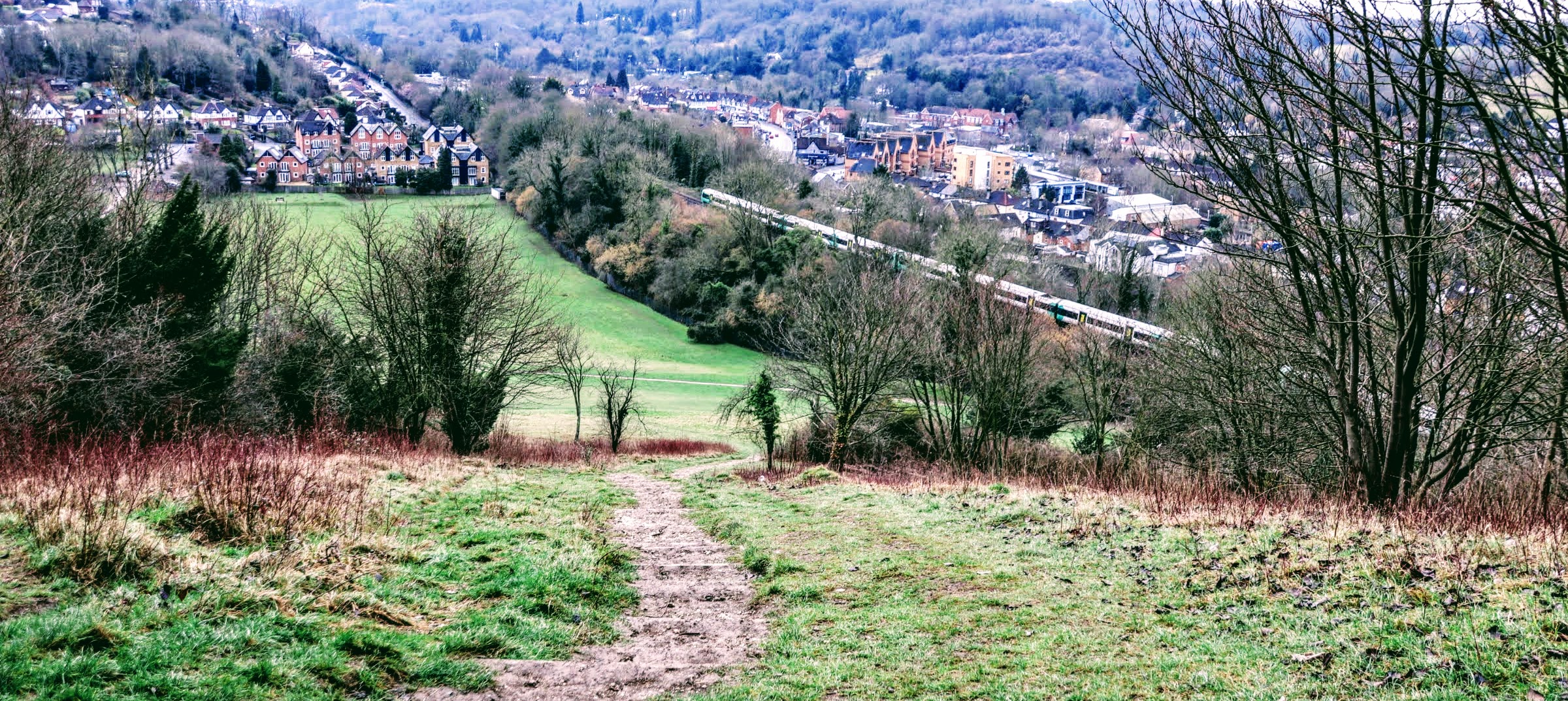
But the view when you reach the top is quite something, and if you know where to look, you can see both Upper Warlingham and Whyteleafe stations. I timed this shot as a London-bound train had just left Upper Warlingham. You can make out the Devil’s Steps in the foreground leading down to the recreation ground.

I was unprepared for rambling across The Dobbin, mainly as the ground was muddy and slippery and the rain had set in. And the higher I climbed, the rain turned to snow. I met several walkers better equipped than I was, so I returned to the recreation ground through Crewe’s Wood, skirting Riddlesdown Quarry in the process. It was still a tricky descent, as the wooded path was muddy and slippery.
I leave the recreation ground under Bridge 504, leading to Maple Road. The bridge carries the Oxted line and is about 500 metres north of Upper Warlingham station, and it is used as a shortcut for students from the sixth form college from the other side of the grounds.

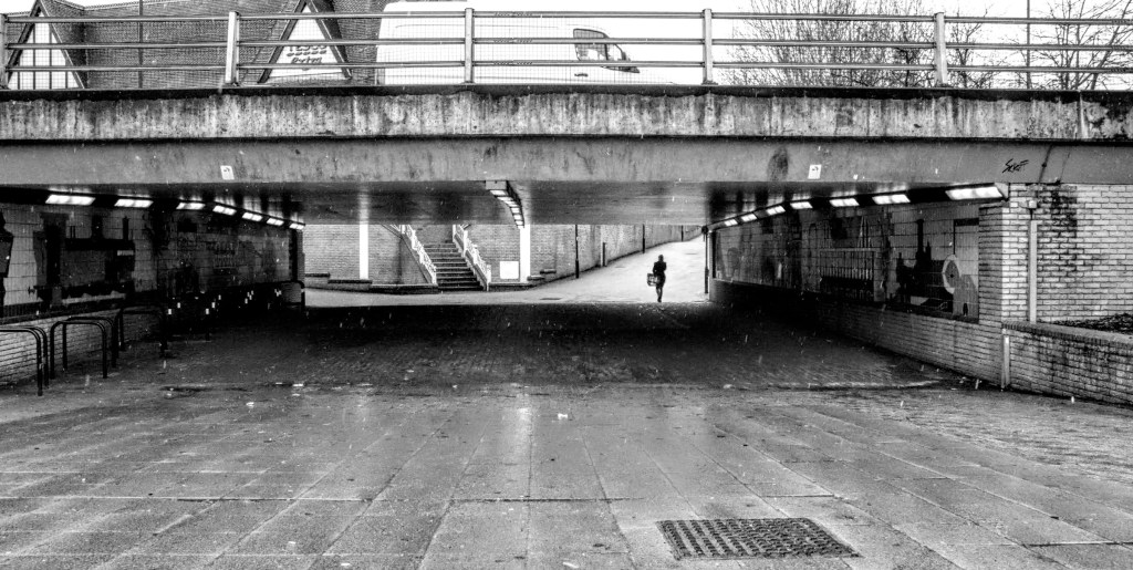
On making my way to the main road, I’d decided to walk to Kenley station, but the rain got the better of me, so I jumped on the first bus that took me to Purley. Alas, this was the briefest of visits as the rain alternated with snow showers. So my attention focussed on the Purley Way underpass, as it kept me dry.
So I end my day travelling with a couple of images for your amusement.
Picture of the Day – The Old Wheelwrights and Blacksmiths Shops
These two well-preserved buildings, next to Triangle House, Whyteleafe’s first shop on the corner of the main Godstone Road and St Luke’s Road, stand out elegantly, showing off their decorative flint and brickwork.
Named The Old Wheelwrights Shop and the Old Blacksmiths Shop, there’s no need to guess what they once were. And I suspect they may have been associated with a nearby Coaching Inn, given their proximity to one of London’s main coaching routes.
The building’s stonemasonry and paintwork made these ideal black-and-white photo candidates, and with some post-production filtering, I’ve tried to capture their character.
Although the two buildings appear the same, their ground-floor doors and windows differentiate them enough to give them their character. The modern ‘One Way’ sign and satellite dish could be a distraction, but for me, they help place these historic buildings in the 21st Century.
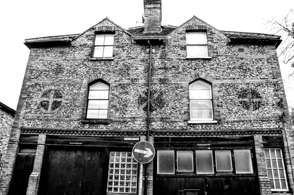
- Location: St Luke’s Road, Warlingham
- Date/Time: Thursday 7th March 2023, 11.57 am
- Settings: Camera – Canon EOS 200D; Aperture -f/10; Shutter Speed – 1/10; Focal Length – 18mm; Film Speed – ISO100
Social Media
Please follow me on my social media channels: Instagram, Facebook, and Twitter if you like what you see.


Leave a comment